

Biking
& Hiking
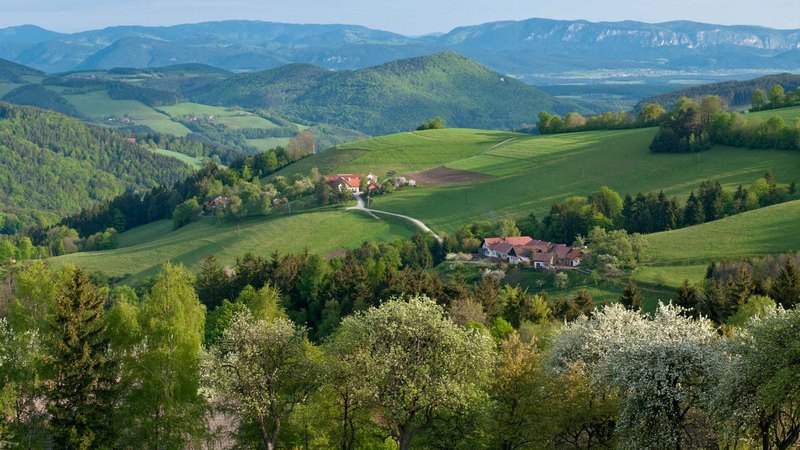
![[Translate to English:] E-Bike Bucklige Welt](/fileadmin/_processed_/b/2/csm_ebike-aussichtsroute-bw-04_c_wieneralpen-kremsl_664f527569.jpg)

South of Vienna starts the „Wiener Alpenbogen“. From the hills of the Bucklige Welt, it rises up to the Wechsel and the Semmering. Rax and Schneeberg are its hightest points, before it lowers again to the Hohe Wand. A hiking trail leads in 19 stages, all together 300 kms long, all along.
http://www.wieneralpen.at/wege
Alpannonia long distance hiking trail - side route from Kirchschlag to Habich (Etappe 4) about 2 hrs
http://www.alpannonia.at
Wanderweg Kirchschlag - Hutwisch
Marienweg Lockenhaus - Kirchschlag
The most relaxed way to discover the many hills of our home country, is by E-Bike. 5 marked routes with a total of 99 kms, will lead you to the most beautiful spots. show details
Kirchschlag is situated on the Zöbernbach Bike Trail, connecting Euro Velo 9 from Aspang to the Rabnitztal Radwanderweg in the Burgenland. www.outdooractive.com
Bucklige Welt & Burgenland Panorama Tour - GPS download available on www.komoot.de
Auf den Hutwisch - GPS download available on www.komoot.de
Durch das Hollerbachtal - GPS download available www.komoot.de
Zum Guglhupf - GPS download available on www.komoot.de
Zum Platz der Stille - GPS download available on www.komoot.de
Zum Steinkreis - GPS download available on www.komoot.de
E-Bike Hire
Sport 2000 Picher hires out E-Mountainbikes and E-Touringbikes. Reservation recommended!
Bike storage room for hotel guests.
Every year MTB Races are held around Kirchschlag:
- Bike the Bugles in Krumbach http://www.bikethebugles.at
- Schloßberg XC in Kirchschlag www.schlossbergxc.at
Motocross Races MSC Kirchschlag: http://www.msckirchschlag.at